

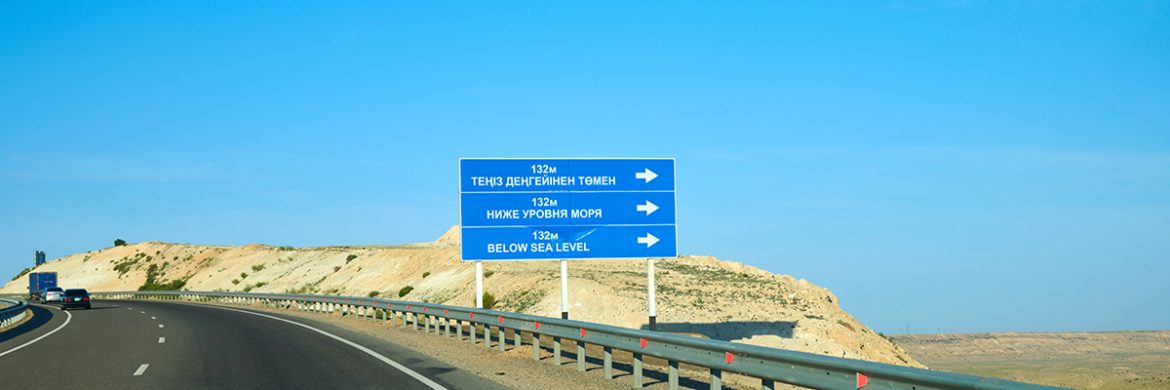
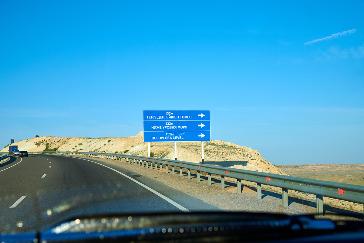
The Karagiye Depression, renowned as the deepest depression in Asia, stands out as a prominent tourist destination in the Mangystau region. Situated 50 kilometers from the regional hub of Aktau, this geological wonder marks the lowest point in Kazakhstan, reaching an impressive depth of 132 meters below sea level. Globally, it secures the fifth position in terms of depth, making it a fascinating natural marvel for visitors to explore.
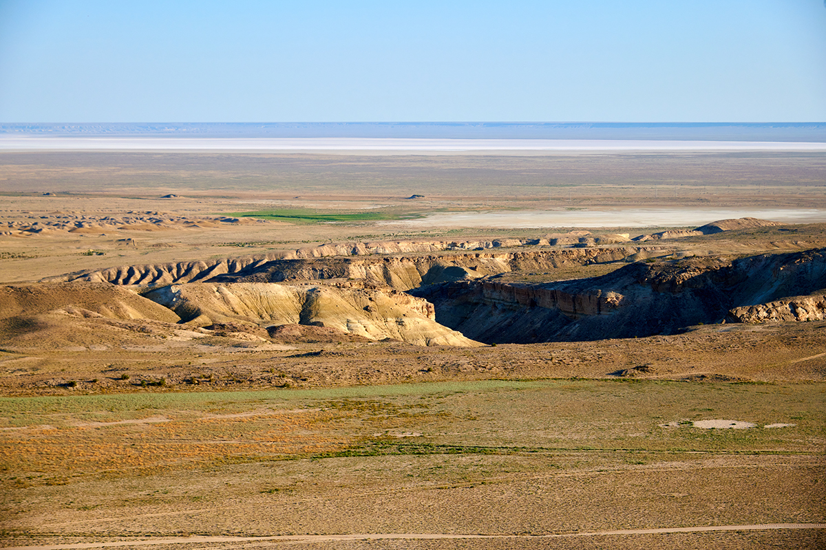
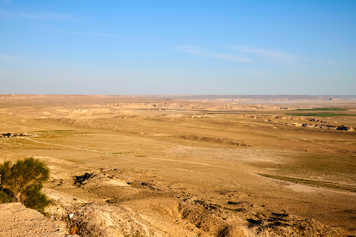
This tourist site astounds with its extraordinary beauty, resembling a vast, deep bowl spanning 85 kilometers in length and 25 kilometers in width. The Karagiye Depression, situated in the Mangystau region, is not only visually captivating but also holds the surprising distinction of being considered the birthplace of rain. Despite its own microclimate being remarkably dry, meteorologists attribute this phenomenon to the hot air at the depression’s bottom. Scientifically, the depression acts as a natural generator, contributing to the formation of rain clouds in the atmosphere. In the summer, these clouds accumulate over the depression, stretching for several kilometers, as confirmed by underground observations and satellite photographs. This unique interplay of geological and meteorological elements enhances the mystique of this remarkable natural wonder.
The depression’s floor is adorned with salt marshes, featuring primarily few-flowered wormwood in its flora.
Various interpretations surround the ancient Turkic meaning of the word » Karagiye,» including «black descent,» «black mouth,» or «black slope.» Interestingly, the external appearance of the Karakiya Depression aligns aptly with its name, considering these interpretations.
Local residents also refer to the depression as «Batyr,» a name with historical significance. In the past, the depression housed a saltlake known as Batyr, stretching 40 kilometers in length and 10 kilometers in width. The origin of the lake’s name remains a topic of debate among scientists, ethnographers, and local historians. One theory suggests that it was named after a warrior named Er Tolep Anetuly, who stood guard on the surrounding mountain peaks for many years. Evidence includes a sentinel height known as «Tolep Hill» («Tolep Shokysy») and several well sites, believed to be where the batyr watered his horse.
Notably, the highway of republican significance, connecting the regional center, the city of Aktau, with Zhanaozen, traverses the Karagiye Depression.
For those eager to explore and appreciate the depression up close, it is recommended to visit the site through local travel agencies or with the guidance of a professional tour guide, as traveling in lowlands can pose certain risks.
The Karagiye Depression stands as a compelling testament to the mysteries concealed beneath every stone and hill in the Mangystau region, inviting curious travelers to uncover its secrets.