

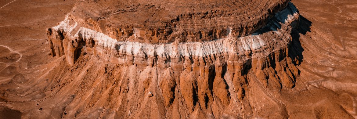
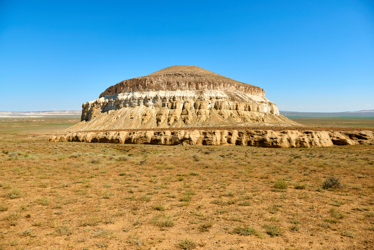
Another wonder of the open-air museum that is Mangistau is Mount Sherkala. It is a quadrilateral mountain formed in a special shape due to earthquakes. The mountain, which some likened to an inverted cup, and others to the image of a yurt, was formed from limestone and clay rocks of the Paleogene era.
During a geological expedition led by the Polish revolutionary B. Zalessky in 1851, he eloquently expressed his awe at the sight of Sherkala from a distance, likening it to the magnificent pantheons of Rome and ancient monuments. As he approached closer, he observed columns resembling private walls and white mountains, giving the impression of ruined statues. His vivid description was complemented by a drawing of the mount. Notably, the renowned poet Taras Shevchenko also immortalized the beauty of this place through his artistic work.
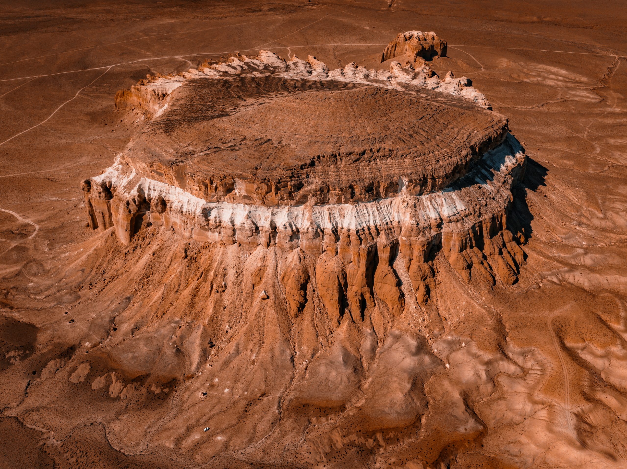
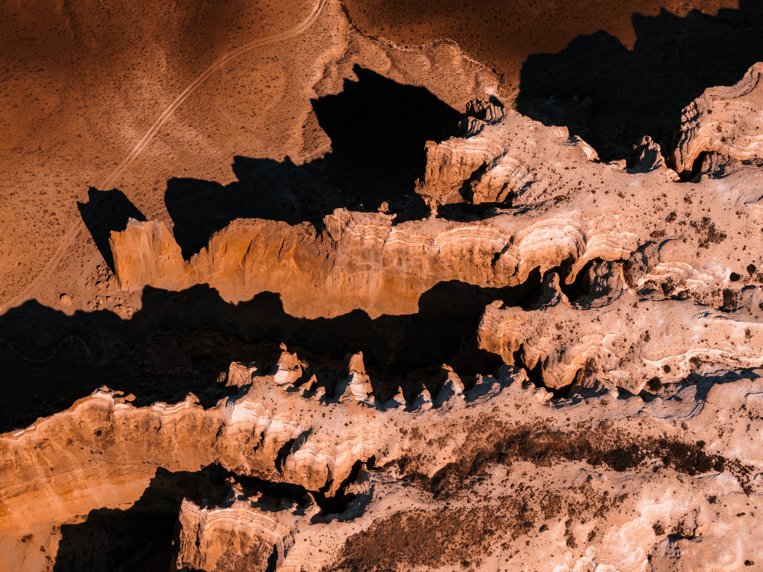
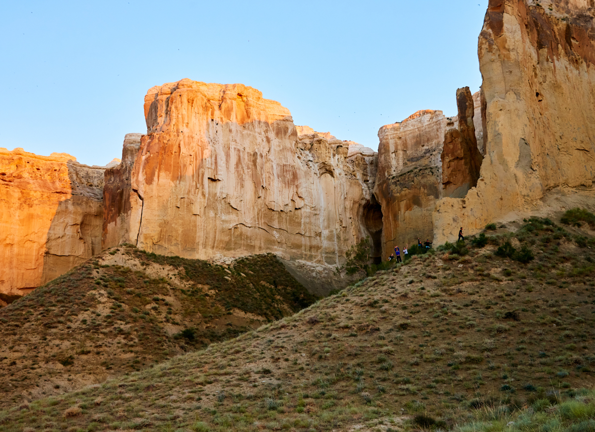
The highest point of the mountain, a subject of local legends, stands tall at 332 meters. Ascending this peak is no easy task; it requires special clothing and preparation. However, the surface is smooth and comfortable for walking. There are even stories of people residing at the mountaintop to shield themselves from adversaries. Its length stretches to 300 meters. The distinctive shape we witness today is a result of wind and water sculpting it over hundreds of years. While it appears brownish and uniform from a distance, it boasts a limestone-white streak and various-sized gaps from bottom to top. The southern and eastern sides are steep, while the upper part has been eroded away. On one side, it appears compact and rounded, but on the other, the ridge takes on the form of a cave with stone crevices of differing lengths. Evidently, mountain rivers and waterfalls once flowed in front of these gorges. Additionally, there is a smaller second ridge visible from this perspective; it is sharper, more limestone-like compared to the main mountain.
The northern side of the mountain continues with the remains of a small fortified settlement from the beginning of the 12th-13th centuries. This part of the mountain was suitable for living. A carved image of a camel caravan is preserved on one of the walls of the water-washed canals here. Archeological research has revealed that earlier this place was a trading post connected with the neighboring medieval city of Kyzylkala. A cache of gold coins and coins was found in an ancient trading post. The material data found informs about the Turkmen culture in the Middle Ages. The main part of the dinars belongs to Ala ad-din Tekesh (1193-1200) and his son Muhammad ibn Tekesh (1200-1220), Khorezmshah of the Anushtegin dynasty. The seven coins were made similar to the official currency of the rulers of Khorezm. From the similarity of the coins, it can be assumed that the gold coins were minted here.
Locals say that this place played a special role in previous wars, especially in the Kazakh-Turkmen battles, and was a refuge for Turkmens. Also, in another legend, it is said that the heroes of some peoples made this place their fortress and fought with their enemies like tigers. The last remaining fighters hid under Sherkala and stayed there forever. It is for this reason that the mountain is called «Sherkala» – «the city of tigers.»
The legendary settlement in the region is located 170 km from the city of Aktau and 22 km from the village of Shetpe. It can be reached in 3 hours by SUV from the center of the region. The best seasons to travel are spring and autumn. If you come to this place with a tent for the night, then even better, because the view of the mountain at different times of the day is unique, each being beautiful in its own way. And climbing the mountain takes some time, but the effort you put in is definitely worth the wonderful views that open up from the top of the mountain.